Rashaant (Rashaant)
Rashaant (Рашаант = in the spring) is a sum of Khövsgöl aimag. The area is about 1,980 km², of which 50 km² are farmland. In 2000, the sum had 3280 inhabitants. The town of Rashaant, the aimag center, is located in a high valley, 154 km southeast of Mörön and 518 kilometers from Ulaanbaatar and had 978 inhabitants in 2009.
The Rashaant sum was founded, together with the whole Khövsgöl aimag, in 1931. The sum center was placed near the Khyalganat monastery (often also referred to as Rashaantyn Khüree), which had been founded in 1915. In 1932, the monastery was the starting point of an armed rebellion that encompassed large parts of western Mongolia, and the sum center was burnt down. In 1933, the sum had about 2,400 inhabitants in 719 households, and about 47,000 heads of livestock. In 1955, Rashaant sum was united with Tarialan, but became separate again in 1959. The local negdel Ulaan Od (Red Star) was founded in 1952 and continued to exist after 1990 as a private farming company. After 1990, the monastery was rebuilt. It is in the northern part of Rashaant Town.
The Rashaant sum was founded, together with the whole Khövsgöl aimag, in 1931. The sum center was placed near the Khyalganat monastery (often also referred to as Rashaantyn Khüree), which had been founded in 1915. In 1932, the monastery was the starting point of an armed rebellion that encompassed large parts of western Mongolia, and the sum center was burnt down. In 1933, the sum had about 2,400 inhabitants in 719 households, and about 47,000 heads of livestock. In 1955, Rashaant sum was united with Tarialan, but became separate again in 1959. The local negdel Ulaan Od (Red Star) was founded in 1952 and continued to exist after 1990 as a private farming company. After 1990, the monastery was rebuilt. It is in the northern part of Rashaant Town.
Map - Rashaant (Rashaant)
Map
Country - Mongolia
 |
|
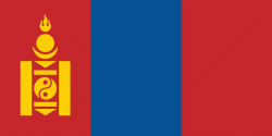
| Flag of Mongolia | |
The territory of modern-day Mongolia has been ruled by various nomadic empires, including the Xiongnu, the Xianbei, the Rouran, the First Turkic Khaganate, and others. In 1206, Genghis Khan founded the Mongol Empire, which became the largest contiguous land empire in history. His grandson Kublai Khan conquered China proper and established the Yuan dynasty. After the collapse of the Yuan, the Mongols retreated to Mongolia and resumed their earlier pattern of factional conflict, except during the era of Dayan Khan and Tumen Zasagt Khan. In the 16th century, Tibetan Buddhism spread to Mongolia, being further led by the Manchu-founded Qing dynasty, which absorbed the country in the 17th century. By the early 20th century, almost one-third of the adult male population were Buddhist monks. After the collapse of the Qing dynasty in 1911, Mongolia declared independence, and achieved actual independence from the Republic of China in 1921. Shortly thereafter, the country became a satellite state of the Soviet Union, which had aided its independence from China. In 1924, the Mongolian People's Republic was founded as a socialist state. After the anti-communist revolutions of 1989, Mongolia conducted its own peaceful democratic revolution in early 1990. This led to a multi-party system, a new constitution of 1992, and transition to a market economy.
Currency / Language
| ISO | Currency | Symbol | Significant figures |
|---|---|---|---|
| MNT | Mongolian tögrög | ₮ | 2 |
| ISO | Language |
|---|---|
| MN | Mongolian language |
| RU | Russian language |


